
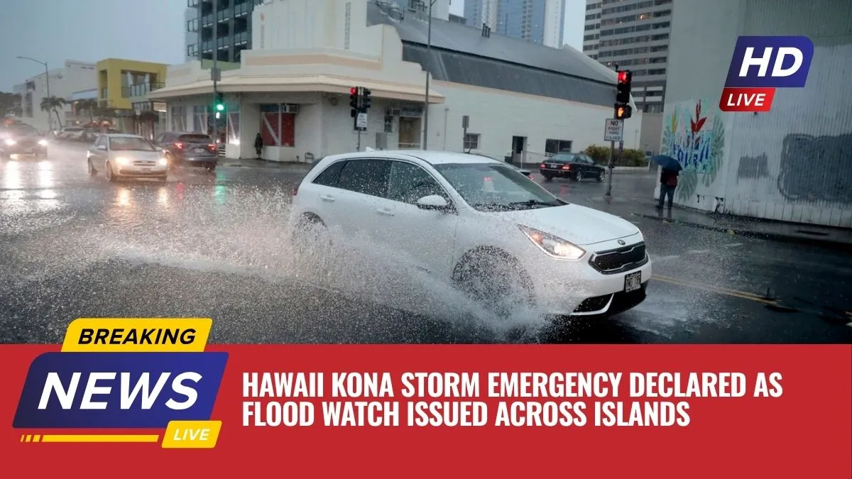
Hawaii is preparing for a severe Kona Storm expected to bring heavy rain, flash flooding, and strong winds across several islands this week. The approaching Kona Storm has already prompted officials to issue a flood watch and take precautionary actions to protect residents and visitors.
Governor Josh Green has signed an emergency proclamation ahead of the Kona Storm, allowing state and county agencies to mobilize resources and respond quickly to any weather-related emergencies. Authorities say the developing Kona Storm could bring days of intense rainfall, thunderstorms, and potentially damaging winds across the Hawaiian Islands.

Officials are urging residents to stay alert and prepare for worsening conditions as the Kona Storm approaches and strengthens through the week.
State Parks and Trails Closed Due to Kona Storm
As the Kona Storm threat increases, the Hawaii Department of Land and Natural Resources (DLNR) has temporarily closed several parks and trails to ensure public safety.
Closures on Kauai
The following areas have been closed due to the expected impacts of the Kona Storm:
- Polihale State Park
- Kalalau Trail

Camping restrictions have also been implemented:
- Campers staying in Kokee State Park were allowed to remain overnight on Monday.
- However, they were required to leave by 11 a.m. Tuesday.
- Camping permits across all state parks have been suspended until further notice due to the Kona Storm.
Closures on Oahu
Authorities also closed the Mokuleia section of Kaena Point to the public. Only vehicles with special permits are currently allowed access.
Officials from the Division of Conservation and Resources Enforcement and State Parks Division are actively notifying campers and hikers in these areas and helping them safely evacuate before the Kona Storm intensifies.

Residents and visitors are strongly advised to avoid forested areas and coastal zones because of risks such as:
- Rising streams
- Flash flooding
- Falling trees
- High surf
- Storm surge
Flood Watch Issued Across Multiple Islands
The National Weather Service (NWS) has issued a flood watch as the Kona Storm approaches Hawaii.
Flood Watch Timeline
| Island Region | Flood Watch Start | Expected Flood Risk Period |
|---|---|---|
| Kauai & Niihau | Tuesday morning | Tuesday morning – Saturday afternoon |
| Oahu | Tuesday evening | Tuesday evening – Saturday afternoon |
| Maui County | Wednesday morning | Wednesday – Saturday afternoon |
Forecasters warn that the Kona Storm could generate intense rainfall rates, increasing the risk of flash flooding, especially in low-lying areas and near streams.
Why the Kona Storm Is Considered Dangerous?
Meteorologists explain that the developing Kona Storm originates from a Kona low pressure system forming northwest of Hawaii. This type of system pulls warm tropical moisture toward the islands, fueling heavy rainfall and thunderstorms.
Weather experts say the Kona Storm could produce:
- Continuous bands of heavy rain
- Thunderstorms with intense rainfall
- Rapid rises in streams
- Flooded roads and neighborhoods
Urban areas and smaller islands could face the highest flooding risk as the Kona Storm continues to draw moisture across the state.
Storm Progression Across the Islands
According to forecasters, the Kona Storm is expected to reach Kauai and Oahu first, before gradually spreading across the rest of the island chain.
By midweek, the storm could intensify and bring additional threats including:
- Strong to severe thunderstorms
- Gusty southerly winds
- Potentially damaging wind conditions
If the Kona Storm strengthens further, strong Kona winds could develop later in the week, possibly causing downed trees and power lines.
Marine Conditions Expected to Worsen
The approaching Kona Storm is also affecting ocean conditions around the Hawaiian Islands.
A Small Craft Advisory remains active until 6 p.m. today for:
- Pailolo Channel
- Alenuihaha Channel
- Waters surrounding the Big Island
East winds reaching 25 knots could create hazardous conditions for smaller boats.
Weather Forecast for the Coming Days
Before the Kona Storm fully develops, conditions across Hawaii are expected to remain mostly cloudy with scattered showers.
Current Weather Conditions
- High temperatures: 78°F to 83°F
- Winds: East-southeast 10–20 mph
- Light vog may linger
Tuesday Forecast
As the Kona Storm approaches:
- Clouds will increase across the islands
- Kauai and Oahu may experience frequent showers and isolated thunderstorms
- Maui County will likely see scattered showers
Expected temperatures:
- Highs: 77°F to 82°F
- Winds: South winds increasing to 15–25 mph
Midweek to Weekend Forecast
From Wednesday through Friday, the Kona Storm could bring:
- Cloudy skies statewide
- Numerous showers
- Scattered thunderstorms
- Locally heavy rainfall
Temperatures are expected to remain stable:
- Daytime highs: 77°F – 82°F
- Nighttime lows: 66°F – 71°F
Winds may strengthen to 20–30 mph by Friday.
Officials Urge Residents to Prepare
Governor Josh Green emphasized that public safety remains the state’s top priority as the Kona Storm approaches.
By issuing the emergency proclamation early, authorities can coordinate resources across agencies and ensure emergency responders are ready.
Residents are encouraged to:
- Monitor weather updates regularly
- Clear drainage areas and storm drains
- Prepare emergency supplies
- Sign up for local emergency alerts
The Hawaii Emergency Management Agency is working closely with the National Weather Service and county emergency offices to track the Kona Storm and respond quickly to any emergencies.
Residents can visit ready.hawaii.gov for preparedness resources and safety guidance.
The approaching Kona Storm poses a serious weather threat to Hawaii, with heavy rain, flash flooding, and strong winds expected across several islands. Authorities have already declared an emergency and implemented safety measures such as park closures and flood watches.
As the Kona Storm develops throughout the week, residents should remain vigilant, follow official guidance, and prepare for potential flooding and severe weather conditions.